✕ Services Areas FAQ Articles Ask Gerry (425) 967-3498 Get A Quote
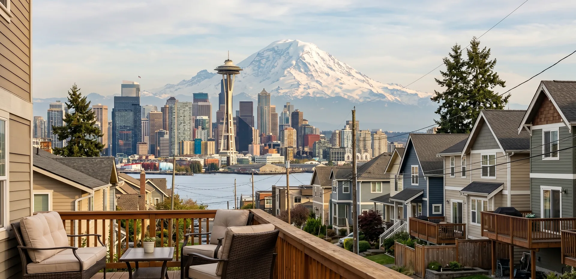
Seattle skyline and Mount Rainier seen from a residential deck
King County · Washington State

Home
Appraisals in
Seattle

Washington State Licensed and Certified Appraisers serving the greater Puget Sound area.

Who appraises homes in Seattle?

AppraisalMS appraises Seattle homes and condos for purchases, refinances, estates, divorce and tax appeals, from our office in Lynnwood. To start a quote, type the property address at the top of this page or phone (425) 967-3498.

The 2020 Census counted 737,015 Seattle residents, up from 608,660 in 2010.

Five Seattle neighborhoods up close

Ballard

A town from 1889 until it joined Seattle in 1907, Ballard runs from the Ship Canal to NW 85th Street. Vintage houses share blocks with apartment buildings from the growth after the late 1990s, so new construction never stands in for older houses.

Capitol Hill

Between I-5 and 23rd Avenue E., about 19,600 people live per square mile, in anything from studio buildings to 14th Avenue E. mansions. Roughly 4,600 units went up from 2010 to 2015. On a condo, the building's finances count as much as the unit.

Queen Anne

The hill has 120 public staircases and seven of the city's 20 steepest streets. Renters hold 63 percent of households, and two old schools are now condominiums. Views and driveway grades change lot to lot, so we judge both in person.

West Seattle

Everything west of the Duwamish River, from Alki Point to Arbor Heights. The West Seattle Bridge was closed from March 2020 to September 2022, and sales from those months are read with that in mind. Ground rises to 520 feet at High Point.

Columbia City

A town from 1893 until 1907, with a National Register historic district since 1980 and light rail since July 2009. Craftsman bungalows sit near apartments and townhome developments, so a bungalow gets bungalow comps and a townhome gets townhome comps.

All Seattle neighborhoods on the atlas

  • Broadview A North Seattle neighborhood on the Clerk's atlas, and any view a listing claims is confirmed from inside the house.
  • Bitter Lake Takes its name from a small lake, and homes that face the water are compared with each other first.
  • North Beach / Blue Ridge Two names the atlas pairs as one North Seattle neighborhood, so we check which name a listing used before matching sales.
  • Crown Hill Begins on the north side of NW 85th Street, the line that marks the top of Ballard.
  • Greenwood Borders Ballard on the east along 3rd Avenue NW, per Ballard's boundary description.
  • Northgate Light rail reached Northgate in October 2021 and height limits near the station went up to 85 feet, so nearby lots are read for redevelopment potential.
  • Haller Lake Grouped under Northgate on the atlas and named for its small lake, where frontage on the water is confirmed on site.
  • Pinehurst A Northgate area neighborhood on the atlas, where we compare homes of similar age before widening the search.
  • North College Park (Licton Springs) The atlas name is North College Park, though most people say Licton Springs, so we search sales under both names.
  • Maple Leaf Another atlas neighborhood under Northgate, where home age and lot size are matched before looking farther out.
  • Lake City Incorporated as a township in 1949 with more than 40,000 residents and annexed in 1954, when Seattle's limits moved from 85th to 145th Street.
  • Cedar Park Grouped under Lake City on the atlas, inside the area Seattle took in with the 1954 annexation.
  • Matthews Beach A Lake City area name on the atlas; if a home has lake frontage, only other lakefront sales set its value.
  • Meadowbrook Part of the Lake City group, where we check for creek corridors that can shrink the usable yard.
  • Olympic Hills Listed under Lake City on the atlas, inside the limits Seattle reached in 1954.
  • Victory Heights A Lake City area neighborhood that carried racial restrictive covenants in 1923, per Wikipedia, and older title documents may still show that language.
  • Wedgwood A North Seattle atlas neighborhood, compared first with sales inside its own streets.
  • View Ridge As the name suggests, view is the question here, and we confirm it from the house before rating it.
  • Sand Point The atlas uses this name for the area around Magnuson Park, and homes are compared on how close they sit to the park.
  • Roosevelt A North Seattle atlas neighborhood where we compare homes against nearby sales from the same build era first.
  • Ravenna A separate town until Seattle annexed it in 1907, and the atlas places the University Village shopping center inside it.
  • Bryant A North Seattle atlas neighborhood where condition and update level carry most of the comparison.
  • Windermere The atlas folds Hawthorne Hills into Windermere, so sales are sorted by which side of Sand Point Way they sit on.
  • Hawthorne Hills Many residents treat the part west of Sand Point Way as its own neighborhood, apart from Windermere, and we follow that local usage when picking comps.
  • Laurelhurst A North Seattle atlas neighborhood where waterfront, view and interior lots go into separate groups.
  • University District Called Brooklyn in the 1890s and 1900s, it holds the UW campuses and The Ave, so distance from campus goes into the location notes.
  • University Village Mostly the name of the shopping center, but locals use it for the streets around it, so a home described this way is placed by its true atlas neighborhood.
  • Wallingford Includes the historic Latona area and usually Tangletown, also called Meridian, which some people place in Green Lake instead.
  • Northlake An atlas neighborhood named for the north side of Lake Union, where any water view is confirmed from the home.
  • Green Lake Built around the lake of the same name, and homes facing the water are compared with each other before anything a block back.
  • Fremont Meets Ballard at 3rd Avenue NW, the boundary Ballard shares with Phinney Ridge and Greenwood.
  • Phinney Ridge Borders Ballard along 3rd Avenue NW, and on a ridge a view is confirmed from inside before it counts.
  • West Woodland A Ballard subarea on the atlas, valued against Ballard sales of the same housing type first.
  • Whittier Heights Another Ballard subarea, where remodeled square footage is matched to permits before it counts toward value.
  • Adams The atlas name for part of Ballard, which incorporated as a town in 1889 and joined Seattle in 1907.
  • Sunset Hill A Ballard subarea whose name promises a western outlook, and we rate any Sound view only after seeing it.
  • Loyal Heights A Ballard subarea on the atlas, compared first with Sunset Hill and Whittier Heights sales.
  • Magnolia A headland with Discovery Park (534 acres) and only three road bridges over the rail yard, so access and view both go into the site description.
  • Lawton Park A Magnolia subarea on the atlas; Discovery Park, the old Fort Lawton, covers much of the headland.
  • Briarcliff A Magnolia subarea, where position on the hill decides whether a home sees the water.
  • Southeast Magnolia The part of Magnolia nearest the Magnolia Bridge, one of the three road links over the rail yard.
  • Interbay Between Queen Anne and Magnolia along the BNSF tracks and Terminal 91, so the few homes here need a wider comp search.
  • North Queen Anne The north side of the hill toward the Ship Canal, compared with other Queen Anne sales before Fremont or Ballard.
  • East Queen Anne Annexed to McGraw Street in 1883 and beyond it in 1891, on the side of the hill facing Lake Union.
  • Lower Queen Anne (Uptown) Also called Uptown, at the south base of the hill, and its condos are compared with other Uptown buildings first.
  • West Queen Anne The west face of the hill toward Interbay, where we check whether a lot looks out over Elliott Bay.
  • Portage Bay / Roanoke Includes the Roanoke Park Historic District and was annexed in two steps, 1883 and 1891.
  • Broadway The Clerk's Broadway District is larger than what most residents call Broadway, roughly matching Capitol Hill's share of the 1869 city.
  • Pike/Pine An east to west corridor that built a strong identity early this century, and its condos are compared with other mid rise buildings on the hill.
  • Montlake Filed under Capitol Hill by the atlas, though a valley along Boyer Avenue sets it apart from the hill.
  • Stevens An older name used mostly near Stevens School on north Capitol Hill.
  • Interlaken Mostly Interlaken Park and Louisa Boren Park plus a small number of private homes, so sales here are rare and comps come from nearby.
  • Madison Valley Annexed south of East Galer Street in 1883 and the rest in 1891.
  • Renton Hill A name that has mostly faded, though its community club, founded in 1901, was Seattle's first.
  • Madison Park Filed by the atlas under Capitol Hill even though the Arboretum valley separates the two, and Broadmoor sits inside it.
  • Broadmoor A private community with controlled entry inside Madison Park, so sales inside it are kept apart from the streets outside.
  • Lake Union The atlas umbrella for South Lake Union, Westlake and Eastlake, which it labels Cascade in places.
  • South Lake Union Annexed in 1883, and a condo here is compared with other condo sales near the lake before downtown towers.
  • Cascade Once reached west to Terry Avenue and is now generally said to end at Fairview, with part of it cut off by Interstate 5.
  • Westlake The lake's west side by name, grouped under Lake Union, where a water view is rated from the unit itself.
  • Eastlake Between Lake Union and I-5, with Seattle's highest concentration of floating homes, so moorage terms are read before the value is set.
  • Denny Triangle A Downtown subarea on the atlas, where unit floor, view and building amenities lead a condo comparison.
  • Belltown Mostly residential with some offices, and 2nd Avenue and Virginia Street is the highest point in Downtown.
  • Pike-Market The atlas name for the Pike Place Market blocks, where a condo's view and building age are matched closely.
  • Central Business District Downtown's office core on the atlas, where we compare a unit with sales in its own building before looking next door.
  • First Hill Called Pill Hill for its hospitals, it was once the city's most desirable residential area.
  • Pioneer Square The city's original center and the likely origin of the term Skid Road, so the historic district is noted for any condo inside it.
  • International District Also called Chinatown, it takes in Little Saigon east of I-5 and what remains of Japantown, on tidelands filled in 1902.
  • Yesler Terrace A housing project east of I-5 that once reached farther west into what is now Kobe Terrace Park.
  • Central Waterfront Downtown's shoreline on Elliott Bay, where condo water views are confirmed from the unit.
  • West Edge The strip between about First and Second Avenues and Alaskan Way, shared by the business district and Belltown.
  • Central District The atlas divides it into Mann, Minor, Atlantic, Madrona, Harrison / Denny-Blaine and Leschi.
  • Mann An atlas name taken from the old Horace Mann School north of Garfield High School, with little use today.
  • Minor Named for T.T. Minor School, an atlas label most residents do not use.
  • Cherry Hill & Squire Park Partly in the original city, with Squire Park annexed in 1905 and a last enclave in 1921.
  • Atlantic Its north part was in the 1869 city and the land south of Atlantic Street joined in 1883.
  • Judkins Park Grouped under Atlantic on the atlas, and we compare its homes with nearby Atlantic and Central District sales.
  • Madrona South of East Howell Street it was in the 1869 city, and the rest joined in 1883.
  • Madrona Valley A subarea of Madrona on the atlas, where we look at slope and outlook one block at a time.
  • Harrison / Denny-Blaine A Central Area pairing on the atlas where lot position and view decide most adjustments.
  • Washington Park Listed under Harrison / Denny-Blaine, and its sales are compared with that group first.
  • Leschi A Central Area neighborhood on the atlas, where lots are sorted by water frontage, view or neither before comps are picked.
  • Rainier Valley North of Atlantic Street it was in the 1869 city, south to Hanford Street it joined in 1883, and the rest came in 1907.
  • Mount Baker Shares the Rainier Valley annexation history (1869, 1883, 1907), and slope and view are the first things we check.
  • Hillman City South of Columbia City in the Rainier Valley, where we compare homes on age and condition before size.
  • Brighton The lakeshore next to it was once called Brighton Beach, which the atlas now counts as part of Seward Park.
  • Dunlap / Othello A Rainier Valley pairing on the atlas, and a townhome here is compared with townhomes, a house with houses.
  • Rainier Beach / Atlantic City Beach Listed with its old Atlantic City Beach name on the atlas, and lakefront and inland sales are never mixed.
  • Rainier View / Lakeridge The atlas pairs these two names in the Rainier Valley, and we confirm the parcel is inside Seattle before using a nearby sale.
  • Seward Park The atlas uses the park's name for the surrounding neighborhood, which also takes in the old Brighton Beach shore.
  • Lakewood The northern part of Seward Park, whose historic Lakewood Community Club is now the Lakewood/Seward Park Community Club.
  • Beacon Hill Bounded by I-5, I-90 and Rainier Avenue, with many Craftsman bungalows and Seattle box houses on its north end, mostly from the early 1900s.
  • North Beacon Hill Where most of the hill's early 1900s homes stand, near the light rail station at Beacon Avenue South and South Lander Street.
  • Mid Beacon Hill (Maplewood) The middle of the Beacon Hill ridge, also listed as Maplewood on the atlas.
  • Holly Park / NewHolly The former Holly Park housing project, now officially NewHolly, where newer homes are compared against each other first.
  • South Beacon Hill / Van Asselt The south end of the hill, reaching to the city line, where we confirm the school district by address.
  • Industrial District Mostly tidelands west of Beacon Hill filled in 1902, plus land annexed in 1907 and 1910.
  • SoDo Tidelands west of Beacon Hill, platted in 1895 and filled in 1902.
  • Harbor Island Former tidelands grouped with SoDo in the Industrial District on the atlas.
  • Georgetown A city of its own for six years before Seattle annexed it in 1910.
  • South Park A town for five years before its 1907 annexation; we check flood maps for any South Park parcel.
  • Alki Point Where the Denny Party landed in 1851, and beach side and hillside homes here are valued against different sales.
  • North Admiral / Admiral District The north end of West Seattle around Admiral Junction, where Elliott Bay and downtown views are checked from inside the house.
  • West Seattle Junction / Alaska Junction The business center at California Avenue SW and SW Alaska Street, overlapping Genesee on the atlas.
  • Seaview / Mee-Kwa-Mooks Paired with the name Mee-Kwa-Mooks on the atlas, and any Puget Sound view is rated from inside the home.
  • Fairmount Park A West Seattle atlas neighborhood, compared first with Genesee and Junction sales.
  • Genesee Overlaps the Junction on the atlas, so we confirm which name a listing used before treating sales as matches.
  • Gatewood On the southwest end of West Seattle, where position and outlook separate one sale from the next.
  • Fauntleroy One of the southwest end neighborhoods of West Seattle, where water frontage is confirmed on site.
  • Arbor Heights The far southwest corner, brought into the city mostly in annexations of 1950, 1954 and 1956.
  • Delridge Most of it joined Seattle with West Seattle in 1907, and the rest in 1946 and 1949.
  • North Delridge The north part of the Delridge group, where a sale from the 2020 to 2022 bridge closure gets a second look.
  • Pigeon Point The far northeast tip of Delridge, east of Delridge Way and north of Puget Park.
  • Riverview A Delridge area neighborhood; the West Duwamish Greenbelt holds much of West Seattle's green space, and we note any greenbelt edge on the lot.
  • Highland Park Part of the Delridge group on the atlas, compared first with Roxhill and South Delridge.
  • South Delridge The southern stretch of the Delridge group, where we confirm the parcel is inside Seattle before using a sale.
  • Roxhill A Delridge subarea, where build era and lot size steer the comp search.
  • High Point Rebuilt with about 1,600 new housing units, most Energy Star rated, and home to Seattle's highest point, 520 feet at Myrtle Reservoir Park.

What moves home values in Seattle?

Housing type first: a condo, a townhome and a house on one block are separate markets. Then slope, views, floating home moorage and access (Magnolia has three road bridges).

What appraisals does AppraisalMS do in Seattle?

Lenders send us purchase, refinance and FHA orders; owners and attorneys hire us for estate, divorce, pre listing and relocation reports. Appealing a King County value? Use our Seattle area tax appeal guide.

Expect updates as we work and a clean report on the promised date. Our depth with attached homes shows: townhomes get townhome comps, and condo reports start with HOA finances.

Seattle appraisal questions

What does a Seattle appraisal cost and take?
Each job is quoted once we know the home and scope. Seattle reports usually take 7 to 10 days and arrive on the date we set. Ask through the address box above.
Can I order a Seattle estate appraisal myself?
Yes, for estate, date of death, divorce, pre listing and tax appeal work. On a home loan, the lender is the one who orders. For Seattle requests we check the MLS history and county records, then reply to you directly.
How do you value a Seattle view or floating home?
We rate the view from inside, then use sales with a similar outlook, like Elliott Bay from Queen Anne. For a floating home, moorage terms come first.
Do you appraise Seattle condos and townhomes?
Yes. Our team is very experienced with townhomes, condos and every attached dwelling type, from Capitol Hill condo buildings to Columbia City townhomes and Eastlake floating homes.
Which school district covers a Seattle address?
Seattle Public Schools serves almost all of the city, and Highline Public Schools a very small portion, per Wikipedia. Near the south city line, check by address.
Sources for this page

Need a Seattle
appraisal?

Request a Seattle appraisal from AppraisalMS. Enter the address at the top of the page, use the form, or call our friendly team anytime.

Request an Appraisal

Or call us: (425) 967-3498